As the world gets warmer, cities everywhere, including in Saudi Arabia, need to find ways to adapt. Riyadh, Dammam, and Jeddah have special challenges because of their hot climate and fast growth. Temperature mapping is becoming an important tool to help these cities adapt to climate change.
Understanding Climate Change in Saudi Arabia
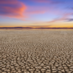
Saudi Arabia is very hot, especially in cities where the Urban Heat Island (UHI) effect is strong. UHIs make cities like Riyadh, Dammam, and Jeddah hotter than nearby rural areas. This leads to more energy use, health problems, and environmental stress. Climate change will make these problems worse, so we need good strategies to adapt.
The Importance of Temperature Mapping
Temperature mapping uses technology to measure and study how temperatures change across a city. It uses satellite images, ground sensors, and aerial surveys to get detailed temperature data in real time. This information is very useful for making plans to adapt to climate change.

Informing Policies and Practices
- Urban Planning and Design: Temperature mapping shows the hottest parts of cities. This helps urban planners design buildings with reflective materials, create more green spaces, and plan city layouts that improve air flow. These strategies can cool down cities like Riyadh, Dammam, and Jeddah.
- Green Infrastructure: Data from temperature mapping helps identify the best places for parks, green roofs, and urban forests. Using drought-resistant plants can reduce temperatures and provide shade, which is especially important in Saudi Arabia’s dry climate.
- Public Health: High temperatures can be dangerous, especially for vulnerable people. Temperature maps help health officials find the areas most at risk for heat-related illnesses. They can then set up cooling centers and improve healthcare during heatwaves.
- Energy Efficiency: Accurate temperature data helps cities use energy better. For example, it can guide where to place solar panels in Jeddah for maximum efficiency. Better building designs with good insulation can also reduce the need for air conditioning, saving energy.
- Disaster Preparedness: Climate change is making extreme weather events more common. Temperature mapping helps cities prepare for and respond to heatwaves. By identifying vulnerable areas, cities can create better emergency response plans.
Our Services in Saudi Arabia
We offer temperature mapping services in Riyadh, Dammam, Jeddah, and all over Saudi Arabia. Our advanced technology and expert team help cities understand their temperature problems and find solutions. We provide satellite and aerial temperature surveys, ground sensors, and detailed reports.
By using our temperature mapping services, Saudi Arabian cities can plan better for a warmer future. Our goal is to help make cities cooler, more resilient, and better places to live.
In conclusion, temperature mapping is essential for adapting to climate change. With detailed temperature data, cities like Riyadh, Dammam, and Jeddah can develop effective strategies to deal with a warming world and become more resilient to future climate challenges.
you can get more information in our site : Redlines.com