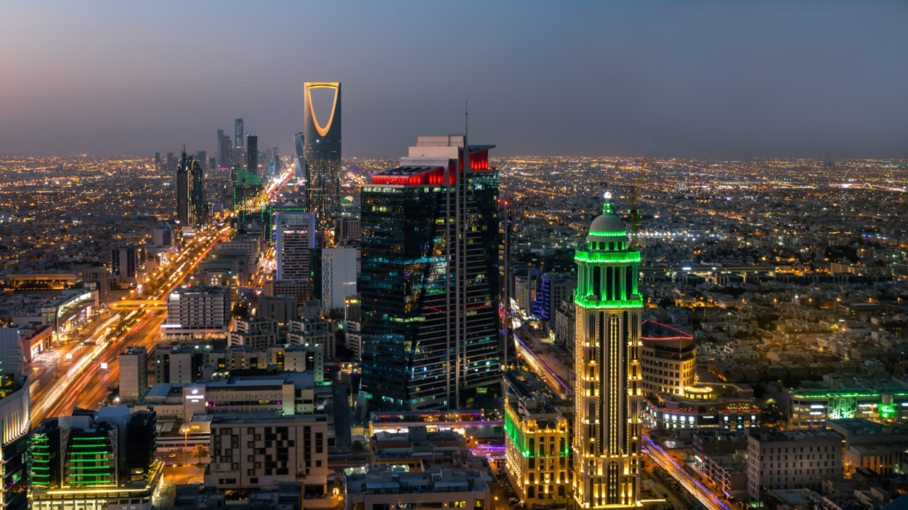
In the rapidly growing urban centers of Saudi Arabia, such as Riyadh, Dammam, and Jeddah, understanding temperature variations is essential for effective urban planning and public health. One of the key tools in this endeavor is temperature mapping, which helps identify “heat islands” — areas that experience significantly higher temperatures than their surroundings. This article outlines the process of temperature mapping and highlights how Redlines is contributing to this important work.
What Are Heat Islands?
Heat islands are urban areas that become significantly warmer than their rural surroundings due to human activities and alterations to the landscape. Factors contributing to heat islands include:
- Concrete and Asphalt: These materials absorb and retain heat, causing surface temperatures to rise.
- Lack of Vegetation: Green spaces help cool the environment, and their absence in urban areas can lead to increased temperatures.
- Energy Consumption: High energy use in cities generates heat, contributing to the heat island effect.

The Importance of Temperature Mapping
Temperature mapping is crucial for identifying heat islands and understanding their impact on local climates. This information can help urban planners, architects, and policymakers design strategies to mitigate heat effects, improving comfort and public health for residents.
The Temperature Mapping Process
- Data Collection: The first step in the temperature mapping process is gathering temperature data. This can be achieved using:
- Ground Sensors: We install sensors at various locations to continuously monitor temperatures.
- Aerial Surveys: Drones equipped with thermal cameras can capture detailed temperature readings over large areas, identifying hot spots quickly and efficiently.
- Satellite Imagery: Satellite data provides an overview of temperature variations across vast urban landscapes.
- Data Processing: After collecting temperature data, the next step is processing it to create meaningful insights. This involves:
- Cleaning the Data: Removing any inaccurate or irrelevant data to ensure the results are reliable.
- Analysis Using GIS: Geographic Information Systems (GIS) are utilized to visualize temperature data on maps, allowing for easy identification of heat islands.
- Identifying Heat Islands: Through analysis, we can pinpoint specific areas that are significantly warmer than their surroundings. This step is vital for understanding where interventions are needed most.
- Recommendations: Based on the findings from the temperature mapping, we provide actionable recommendations for urban development. This may include:
- Increasing Green Spaces: Suggesting the creation of parks and green roofs to help cool the urban environment.
- Improving Urban Design: Advising on the use of reflective materials in buildings and roadways to reduce heat absorption.
- Implementation and Monitoring: Finally, after the recommendations are made, we assist in implementing these strategies and continue monitoring temperature changes over time to assess the effectiveness of the interventions.
Redlines and Temperature Mapping Services
At Redlines, we are dedicated to providing comprehensive temperature mapping services across Riyadh, Dammam, and Jeddah. Our team utilizes the latest technology and methodologies to collect and analyze temperature data, helping local authorities and communities combat the heat island effect.
By identifying and mapping heat islands, we support sustainable urban planning and contribute to creating more livable cities. Our goal is to ensure that the residents of these urban centers can enjoy comfortable and healthy living conditions, even in the face of rising temperatures.
Conclusion
Mapping heat islands through temperature mapping is essential for understanding and mitigating urban heat in Saudi Arabia’s cities. With the help of companies like Redlines, cities can develop strategies to create cooler, more sustainable urban environments. If you’re interested in learning more about our temperature mapping services, please reach out to us!
you can get more information on our site: Redlines.com


