As cities like Riyadh, Dammam, and Jeddah grow and develop, creating sustainable and energy-efficient buildings becomes increasingly important. One of the key tools in designing buildings that are both functional and eco-friendly is temperature mapping. This article explores how temperature data influences architectural design choices to create sustainable buildings and highlights our role in providing temperature mapping services in these cities.
What is Temperature Mapping?
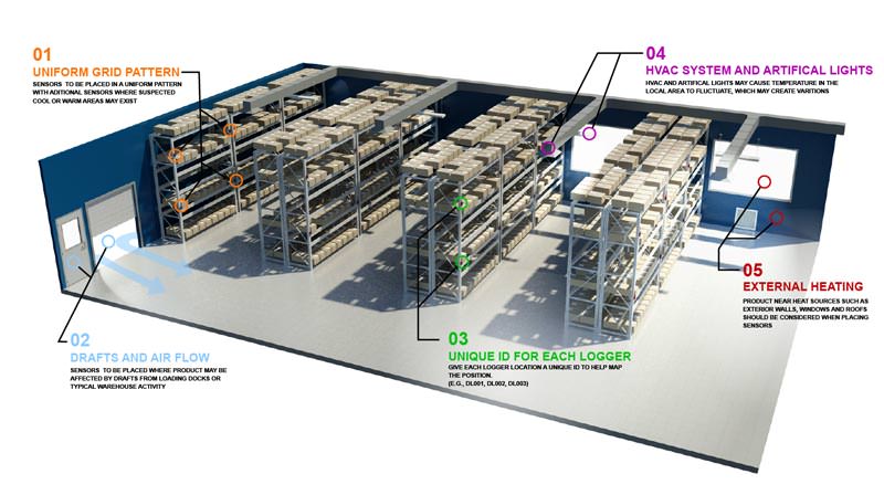
Temperature mapping involves collecting detailed temperature data from various locations within a city. Using advanced technologies such as satellites, ground sensors, and drones, temperature mapping provides a comprehensive view of temperature variations across different urban areas. This data helps architects and planners understand local climate conditions, which is crucial for designing buildings that can handle extreme temperatures effectively.

How Temperature Mapping Influences Architectural Design
- Optimizing Building Orientation: Temperature mapping helps architects determine the best orientation for buildings to minimize heat gain. For example, by analyzing temperature data, architects can position buildings to reduce exposure to the sun’s harsh rays during the hottest parts of the day. This can lead to cooler indoor temperatures and reduced energy consumption for cooling.
- Selecting Appropriate Building Materials: Different materials have varying thermal properties. Temperature mapping data allows architects to choose materials that are best suited for the local climate. In cities like Riyadh, Dammam, and Jeddah, where temperatures can be extreme, materials that reflect heat or have insulating properties can significantly enhance a building’s energy efficiency.
- Designing Effective Ventilation Systems: Good ventilation is essential for maintaining indoor comfort. Temperature mapping helps architects design ventilation systems that are optimized for the local temperature conditions. For example, incorporating natural ventilation strategies in areas with cooler temperatures or using advanced cooling technologies in hotter regions can improve indoor air quality and reduce energy use.
- Incorporating Green Roofs and Walls: Temperature mapping data can guide the design of green roofs and walls, which help to reduce urban heat islands and improve building insulation. By understanding temperature patterns, architects can strategically place vegetation to maximize cooling benefits and create more comfortable urban environments.
- Enhancing Outdoor Spaces: Temperature mapping also informs the design of outdoor spaces such as parks, plazas, and shaded walkways. By knowing where temperatures are highest, planners can design these spaces with appropriate shading, cooling features, and water elements to enhance comfort and usability.
Our Role in Temperature Mapping Services
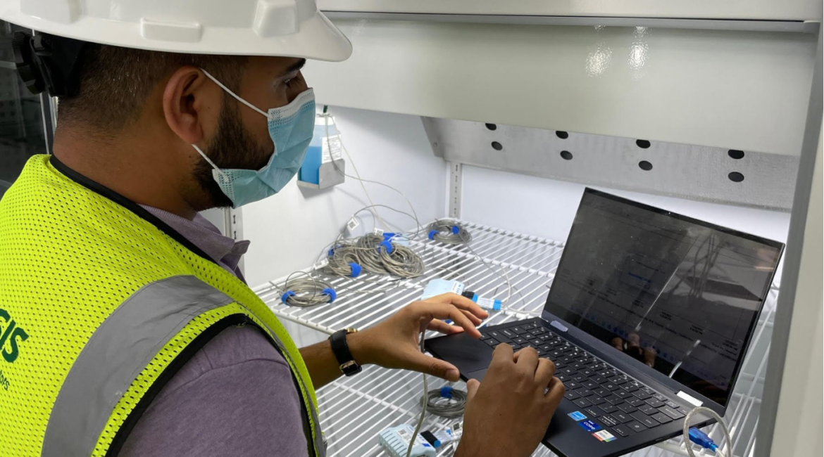
At our company, we specialize in providing temperature mapping services in Riyadh, Dammam, and Jeddah. Our advanced technology and expertise allow us to gather and analyze detailed temperature data, which is essential for architects and urban planners. We work closely with design professionals to apply this data effectively, helping them create sustainable and energy-efficient buildings that are well-suited to the local climate.
Conclusion
Designing sustainable and energy-efficient buildings is crucial for the growth and development of cities like Riyadh, Dammam, and Jeddah. Temperature mapping plays a vital role in this process by providing valuable data that influences architectural design choices. From optimizing building orientation and selecting materials to designing ventilation systems and enhancing outdoor spaces, temperature mapping helps create buildings that are both functional and environmentally friendly. Our company is proud to offer temperature mapping services that support the development of sustainable urban landscapes and contribute to a better quality of life in these cities.
you can get more information on our site: Redlines.com


